

About Us
Founded in 2019, Firefly Aerial are a commercial drone services company based in Cambridge and covering the whole of the UK.
We provide commercial aerial drone services for the collection of photographic images, high resolution video and different types of sensor data including infra-red, multi-spectral and LiDAR from ground level up to 120m.
Our drones are used for everything from the safe and detailed aerial inspection of rooftops and industrial equipment at height through to collecting data and mapping large areas of ground very quickly.
We work with clients across the UK including surveyors, architects, construction companies, energy and utility providers, media organizations, farmers, agricultural companies, and property owners - among many others.
Safe
We operate a "safety first" policy in all our operations, performing full risk assessments and mitigations before - and during - every operation.
Certified
The company is licenced and holds full UK CAA Permission for Commercial Operations for our UAVs. All our pilots hold current certifications for both day and night flights.
Professional
Our pilots are experienced, trained and certified to the highest levels for both flight operations and for the use of UAV technologies such as sensors or mapping software.
Insured
For peace of mind our company and team are fully insured with up to £2m public liability insurance for every job that we do and we are fully compliant with EU regulation EC785/2004.
Cost Effective
It is significantly cheaper and quicker to use our services than to rely on older and less safe methods for working at height or for obtaining accurate aerial photo and video.
Experienced
With four years and thousands of hours of flight time, our team are able to use their experience and skills to always complete the job to your satisfaction.
We always deliver what we promise.
Services
We have a number of different capabilities, from obtaining raw images or delivering post-production finished content for services such as:
Photography & Videography
We produce very hi-resolution images (individually up to 20MP, merged up to 48MP) and video (up to 5.2K/120fps) captured from both aerial and terrestrial perspectives and delivered in whatever format you need - from raw footage and image files through to 3D photogrammetry models.
Aerial Mapping
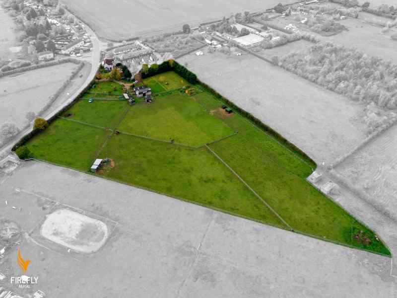
We utilise our fleet of drones to collect technical visual and mapping data from almost any location to create orthomosaic, georeferenced, orthorectified topographical maps, photogrammetric point clouds, digital elevation models, or topological and elevation contour maps.
Inspection
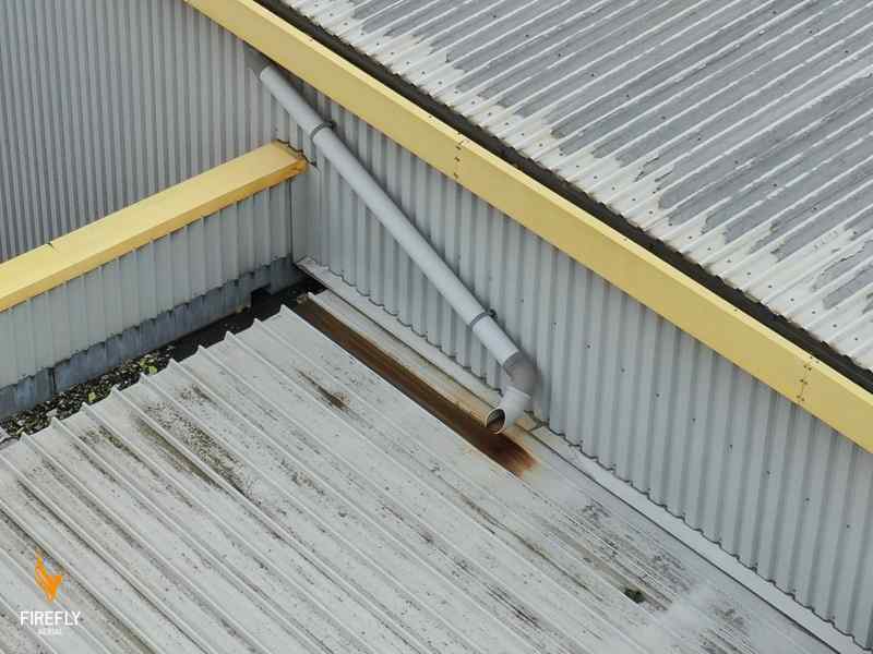
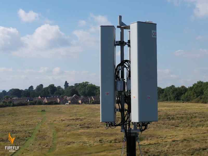
Aerial surveying and detailed inspections of buildings, towers, masts, rooftops, high-level brickwork and other hard to reach objects and buildings – allowing you to get a full evaluation of the condition without having to resort to scaffolding or rope access. We can extend this to the creation of digital twin models suitable for BIM.
Visual Surveying
We create accurate visual maps from altitude with an precision that allows their use by planners and surveyors, as single maps or as bigger blended orthomosaics. We can deliver them in almost any format from GIS files through to full colour terrain maps (DTM and DSM).
Sensor Inspection
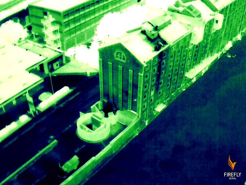
Our drones have the capability to extend our optical images with the use of sensor payloads such as a thermal sensor, multispectral, near infrared (NIR) and LiDAR to increase the amount of data and to obtain extra information such as temperature and colour to create vegetation or weed control maps or accurate asset temperature readings.
Data and Post Production
Sometimes raw footage or photos just aren't enough. We have a post-production editing facility in-house for those occasions. We can also turn data into meaningful information using GIS tools - creating point clouds, volumetric models, orthomosaic and orthorectified terrain maps and many other deliverables and formats.
Partners, Certifications and Memberships





Industries
We provide our services across a number of different industries including:
Surveyors
We extend the capabilities of our Quantity Surveyor partners with detailed inspections at height, near-real time visual maps, land use maps, and provide current terrain mapping to allow them to work faster and more accurately.
Building & Construction
We provide a way to obtain real-time data on tasks such as aerial site survey work, monitoring building progress, site planning and inspection at height - we help make building sites both safer and more cost effective.
Property Management
From rooftop chimney and gutterline surveying, ground and invasive species monitoring, through to building and brickwork condition checking - we can use our drones to quickly and safely help you manage and develop your properties.
Agriculture & Farmers
Using drones, cameras and high specification multispectral sensors to support farmers, growers and agricultural companies in implementing Precision Agriculture and improving yields and profitability.
Transport & Distribution
Traffic monitoring and container counts, container roof observation, rail network vegetation species identification, yard mapping & surveying - all made simpler and performed quickly using our services.
Creative Agencies
High quality video and photography from an aerial viewpoint adds great 'wow factor' to company presentations, collateral and product advertising - and differentiates you from the competition.
Energy & Utilities
Evaluating land for pipe or line work, monitoring temperature on solar farms and wind turbines, or simply taking promotional footage of a new solar farm - we can help with all of these and more.
Conservation & Ecology
From Boundary Mapping and Confirmation, through obtaining Asset/Structure Condition, and identification of Invasive / Non-Native Plant Species; we are able to provide solid, accurate and current data.
Heritage
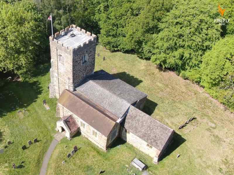
Our drones can survey and obtain a complete and accurate record of the condition of locations, properties and monuments - whether buildings, objects or land features - to assist in maintaining our heritage.
Recent Portfolio
No two jobs are ever the same, but here are a very few illustrations of work we have done recently.
Please contact us if you would like more specific or higher resolution examples.
- All
- Photography
- Inspection
- Surveying
- Mapping





Frequently Asked Questions
Why use drones?
Drones, or UAVs (Unmanned Aerial Vehicles), are changing the way that many companies do business.
Almost any service that needs inspection, mapping, photography, video or sensor data can be improved through the use of drone technology - and much more cost effectively and more safely than traditional methods, especially when working at height or when needing inspection services.
What can you do?
We can take high resolution photographs, UHD video and sensor (multi-spectral and LiDAR) footage of almost any object, building or location from almost any angle between ground level and 120m altitude - at almost any location in the United Kingdom (subject to the location being permitted for flight by national and regional authorities). Among many others we can turn this aerial footage into high resolution still photos, processed video, high resolution maps (visual, orthomosaic or GIS-file), sensor maps, hyperlapse video, 3D models and video.
What can't you do?
There are exceptions, but for the most part we don't do public event photography such as weddings, concerts or parties; or broadcast video, unless they're part of a marketing or advertising video.
We can recommend other companies who specialise in these type of requirements.
How much will your services cost?
The standard answer is "it depends". Cost varies based on a number of factors, including scope of the requirement, number of pilots, number of days, size and duration of the requirement and the deliverables (whether it needs post-processing or is RAW data). We can work to a day rate or an agreed fixed project cost, whichever suits you best.
What qualifications have you got?
In addition to the full Permission for Commercial Operations (PfCO #10673) held by Firefly Aerial, the pilots all hold GVC certifications and the industry-leading ICARUS certifications for piloting sub-25Kg SUAS. They also hold a number of other qualifications, memberships and certifications in skills ranging from photography to cartography. Our pilots are DBS cleared, and we can field a security-cleared team if required for sensitive work.
How do we work with you?
We follow a documented and safety-driven approach to all our engagements, including the production of RAMS documentation.
The first step is to contact us to discuss your requirements - give us a call or drop us an email and we'll get right back to you.
Contact Us
Our Location
Registered Office 2 Minton Place, Victoria Rd, Bicester, OX26 6QB, UK
Operations Office Cambridge
Email Us
info@fireflyaerial.co.uk
Call Us
Enquiries: +44 (0) 7484 121 195